Our mission is to help computational modelers develop, document, and share their computational models in accordance with community standards and good open science and software engineering practices. Model authors can publish their model source code in the Computational Model Library with narrative documentation as well as metadata that supports open science and emerging norms that facilitate software citation, computational reproducibility / frictionless reuse, and interoperability. Model authors can also request private peer review of their computational models. Models that pass peer review receive a DOI once published.
All users of models published in the library must cite model authors when they use and benefit from their code.
Please check out our model publishing tutorial and feel free to contact us if you have any questions or concerns about publishing your model(s) in the Computational Model Library.
Displaying 10 of 60 results region clear search
Peer reviewed Applying Brantingham’s Neutral Model of Stone Raw Material Procurement to the Pinnacle Point Middle Stone Age Record, Western Cape, South Africa
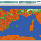
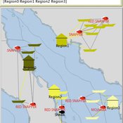
Marco Janssen Simen Oestmo Haley Cawthra | Published Sunday, March 10, 2019This model is an application of Brantingham’s neutral model to a real landscape with real locations of potential sources. The sources are represented as their sizes during current conditions, and from marine geophysics surveys, and the agent starts at a random location in Mossel Bay Region (MBR) surrounding the Archaeological Pinnacle Point (PP) locality, Western Cape, South Africa. The agent moves at random on the landscape, picks up and discards raw materials based only upon space in toolkit and probability of discard. If the agent happens to encounter the PP locality while moving at random the agent may discard raw materials at it based on the discard probability.
Location Analysis Hybrid ABM
Lukasz Kowalski | Published Friday, February 08, 2019The purpose of this hybrid ABM is to answer the question: where is the best place for a new swimming pool in a region of Krakow (in Poland)?
The model is well described in ODD protocol, that can be found in the end of my article published in JASSS journal (available online: http://jasss.soc.surrey.ac.uk/22/1/1.html ). Comparison of this kind of models with spatial interaction ones, is presented in the article. Before developing the model for different purposes, area of interest or services, I recommend reading ODD protocol and the article.
I published two films on YouTube that present the model: https://www.youtube.com/watch?v=iFWG2Xv20Ss , https://www.youtube.com/watch?v=tDTtcscyTdI&t=1s
…
Contract farming in the Mekong Delta's rice supply chain
Hung Nguyen | Published Tuesday, February 05, 2019We study three obstacles of the expansion of contract rice farming in the Mekong Delta (MKD) region. The failure of buyers in building trust-based relationship with small-holder farmers, unattractive offered prices from the contract farming scheme, and limited rice processing capacity have constrained contractors from participating in the large-scale paddy field program. We present an agent-based model to examine the viability of contract farming in the region from the contractor perspective.
The model focuses on financial incentives and trust, which affect the decision of relevant parties on whether to participate and honor a contract. The model is also designed in the context of the MKD’s rice supply chain with two contractors engaging in the contract rice farming scheme alongside an open market, in which both parties can renege on the agreement. We then evaluate the contractors’ performances with different combinations of scenarios related to the three obstacles.
Our results firstly show that a fully-equipped contractor who opportunistically exploits a relatively small proportion (less than 10%) of the contracted farmers in most instances can outperform spot market-based contractors in terms of average profit achieved for each crop. Secondly, a committed contractor who offers lower purchasing prices than the most typical rate can obtain better earnings per ton of rice as well as higher profit per crop. However, those contractors in both cases could not enlarge their contract farming scheme, since either farmers’ trust toward them decreases gradually or their offers are unable to compete with the benefits from a competitor or the spot market. Thirdly, the results are also in agreement with the existing literature that the contract farming scheme is not a cost-effective method for buyers with limited rice processing capacity, which is a common situation among the contractors in the MKD region.
CHAAHK: a Spatial Simulation of the Maya Elevated Core Region
Alex Kara | Published Tuesday, December 04, 2018 | Last modified Thursday, September 26, 2019This thesis presents an abstract spatial simulation model of the Maya Central Lowlands coupled human and natural system from 1000 BCE to the present day. It’s name is the Climatically Heightened but Anothropogenically Achieved Historical Kerplunk model (CHAAHK). The simulation features features virtual human groups, population centers, transit routes, local resources, and imported resources. Despite its embryonic state, the model demonstrates how certain anthropogenic characteristics of a landscape can interact with externally induced trauma and result in a prolonged period of relative sociopolitical uncomplexity. Analysis of batch simulation output suggests decreasing empirical uncertainties about ancient wetland modification warrants more investment. This first submission of CHAAHK’s code represents the simulation’s implementation that was featured in the author’s master’s thesis.
Potato late blight model
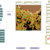
Francine Pacilly | Published Friday, April 13, 2018The purpose of the model is to simulate the spatial dynamics of potato late blight to analyse whether resistant varieties can be used effectively for sustainable disease control. The model represents an agricultural landscape with potato fields and data of a Dutch agricultural region is used as input for the model. We simulated potato production, disease spread and pathogen evolution during the growing season (April to September) for 36 years. Since late blight development and crop growth is weather dependent, measured weather data is used as model input. A susceptible and late blight resistant potato variety are distinguished. The resistant variety has a potentially lower yield but cannot get infected with the disease. However, during the growing season virulent spores can emerge as a result of mutations during spore production. This new virulent strain is able to infect the resistant fields, resulting in resistance breakdown. The model shows how disease severity, resistance durability and potato yield are affected by the fraction of fields across a landscape with a disease-resistant potato variety.
Viticulture development in emerging markets: Małopolska region
Marcin Czupryna Bogumił Kamiński Paweł Oleksy Piotr Przybek | Published Tuesday, November 28, 2017 | Last modified Saturday, June 16, 2018Model explains both the final state and the dynamics of the development process of the wine sector in the Małopolska region in Poland. Model admits heterogeneous agents (regular farms,large and small vineyards).
The Cardial Spread Model
Sean Bergin | Published Friday, September 29, 2017 | Last modified Monday, February 04, 2019The purpose of this model is to provide a platform to test and compare four conceptual models have been proposed to explain the spread of the Impresso-Cardial Neolithic in the west Mediterranean.
The Mobility Model
Emilie Lindkvist | Published Wednesday, September 27, 2017 | Last modified Friday, October 06, 2017The Mobility Model is a model of a small-scale fishery with the purpose to study the movement of fishers between different sub-regions within a larger region, as they move between different regions to fish.
A social network model to analyze team assembly mechanisms
Andreas Koch | Published Monday, April 10, 2017This model simulates networking mechanisms of an empirical social network. It correlates event determinants with place-based geography and social capital production.
Peer reviewed MOOvPOPsurveillance
Matthew Gompper Aniruddha Belsare Joshua J Millspaugh | Published Tuesday, April 04, 2017 | Last modified Tuesday, May 12, 2020MOOvPOPsurveillance was developed as a tool for wildlife agencies to guide collection and analysis of disease surveillance data that relies on non-probabilistic methods like harvest-based sampling.
Displaying 10 of 60 results region clear search