Our mission is to help computational modelers develop, document, and share their computational models in accordance with community standards and good open science and software engineering practices. Model authors can publish their model source code in the Computational Model Library with narrative documentation as well as metadata that supports open science and emerging norms that facilitate software citation, computational reproducibility / frictionless reuse, and interoperability. Model authors can also request private peer review of their computational models. Models that pass peer review receive a DOI once published.
All users of models published in the library must cite model authors when they use and benefit from their code.
Please check out our model publishing tutorial and feel free to contact us if you have any questions or concerns about publishing your model(s) in the Computational Model Library.
Displaying 10 of 1195 results for "Aad Kessler" clear search
Homophily as a process generating social networks: insights from Social Distance Attachment model
Szymon Talaga Andrzej Nowak | Published Tuesday, September 17, 2019This is code repository for the paper “Homophily as a process generating social networks: insights from Social Distance Attachment model”.
It provides all information, code and data necessary to replicate all the simulations and analyses presented in the paper.
This document contains the overall instruction as well as description of the content of the repository.
Details regarding particular stages are documented within source files as comments.
00b SimEvo_V5.08 NetLogo
Garvin Boyle | Published Saturday, October 05, 2019In 1985 Dr Michael Palmiter, a high school teacher, first built a very innovative agent-based model called “Simulated Evolution” which he used for teaching the dynamics of evolution. In his model, students can see the visual effects of evolution as it proceeds right in front of their eyes. Using his schema, small linear changes in the agent’s genotype have an exponential effect on the agent’s phenotype. Natural selection therefore happens quickly and effectively. I have used his approach to managing the evolution of competing agents in a variety of models that I have used to study the fundamental dynamics of sustainable economic systems. For example, here is a brief list of some of my models that use “Palmiter Genes”:
- ModEco - Palmiter genes are used to encode negotiation strategies for setting prices;
- PSoup - Palmiter genes are used to control both motion and metabolic evolution;
- TpLab - Palmiter genes are used to study the evolution of belief systems;
- EffLab - Palmiter genes are used to study Jevon’s Paradox, EROI and other things.
…
ACT: Agent-based model of Critical Transitions
Igor Nikolic Oscar Kraan Steven Dalderop Gert Jan Kramer | Published Wednesday, October 18, 2017 | Last modified Monday, August 27, 2018ACT is an ABM based on an existing conceptualisation of the concept of critical transitions applied to the energy transition. With the model we departed from the mean-field approach simulated relevant actor behaviour in the energy transition.
Peer Review with Multiple Reviewers
Flaminio Squazzoni Federico Bianchi | Published Thursday, September 10, 2015This ABM looks at the effect of multiple reviewers and their behavior on the quality and efficiency of peer review. It models a community of scientists who alternatively act as “author” or “reviewer” at each turn.
Location Analysis Hybrid ABM
Lukasz Kowalski | Published Friday, February 08, 2019The purpose of this hybrid ABM is to answer the question: where is the best place for a new swimming pool in a region of Krakow (in Poland)?
The model is well described in ODD protocol, that can be found in the end of my article published in JASSS journal (available online: http://jasss.soc.surrey.ac.uk/22/1/1.html ). Comparison of this kind of models with spatial interaction ones, is presented in the article. Before developing the model for different purposes, area of interest or services, I recommend reading ODD protocol and the article.
I published two films on YouTube that present the model: https://www.youtube.com/watch?v=iFWG2Xv20Ss , https://www.youtube.com/watch?v=tDTtcscyTdI&t=1s
…
Peer reviewed Casting: A Bio-Inspired Method for Restructuring Machine Learning Ensembles
Colin Lynch Bryan Daniels | Published Thursday, September 18, 2025The wisdom of the crowd refers to the phenomenon in which a group of individuals, each making independent decisions, can collectively arrive at highly accurate solutions—often more accurate than any individual within the group. This principle relies heavily on independence: if individual opinions are unbiased and uncorrelated, their errors tend to cancel out when averaged, reducing overall bias. However, in real-world social networks, individuals are often influenced by their neighbors, introducing correlations between decisions. Such social influence can amplify biases, disrupting the benefits of independent voting. This trade-off between independence and interdependence has striking parallels to ensemble learning methods in machine learning. Bagging (bootstrap aggregating) improves classification performance by combining independently trained weak learners, reducing bias. Boosting, on the other hand, explicitly introduces sequential dependence among learners, where each learner focuses on correcting the errors of its predecessors. This process can reinforce biases present in the data even if it reduces variance. Here, we introduce a new meta-algorithm, casting, which captures this biological and computational trade-off. Casting forms partially connected groups (“castes”) of weak learners that are internally linked through boosting, while the castes themselves remain independent and are aggregated using bagging. This creates a continuum between full independence (i.e., bagging) and full dependence (i.e., boosting). This method allows for the testing of model capabilities across values of the hyperparameter which controls connectedness. We specifically investigate classification tasks, but the method can be used for regression tasks as well. Ultimately, casting can provide insights for how real systems contend with classification problems.
Modeling The Transition to Public School Choice (Model II from paper)
Spiro Maroulis Eytan Bakshy Louis Gomez Uri Wilensky | Published Friday, March 22, 2013 | Last modified Tuesday, August 27, 2013This is an agent-based model that captures the dynamic processes related to moving from an educational system where the school a student attends is based on assignment to a neighborhood school, to one that gives households more choice among existing and newly formed public schools.
Smallholder Behavioural Decisions During Times of Drought Stress
Samantha Dobbie | Published Sunday, September 15, 2013 | Last modified Saturday, September 27, 2014An empirical ABM of smallholder decisions in times of drought stress.
Cultural transmission in structured populations
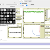
Luke Premo | Published Wednesday, November 13, 2024This structured population model is built to address how migration (or intergroup cultural transmission), copying error, and time-averaging affect regional variation in a single selectively neutral discrete cultural trait under different mechanisms of cultural transmission. The model allows one to quantify cultural differentiation between groups within a structured population (at equilibrium) as well as between regional assemblages of time-averaged archaeological material at two different temporal scales (1,000 and 10,000 ticks). The archaeological assemblages begin to accumulate only after a “burn-in” period of 10,000 ticks. The model includes two different representations of copying error: the infinite variants model of copying error and the finite model of copying error. The model also allows the user to set the variant ceiling value for the trait in the case of the finite model of copying error.
Evolution of cooperation with strangers
Marco Janssen | Published Friday, October 15, 2010 | Last modified Wednesday, November 13, 2013The model is used to study the conditions under which agents will cooperate in one-shot two-player Prisoner’s Dilemma games if they are able to withdraw from playing the game and can learn to recogniz
Displaying 10 of 1195 results for "Aad Kessler" clear search